I have a latent interest in stargazing but haven’t done much about it for a long time until the past weekend when I had a bit of time and wondered if I could create a star map using QGIS. I found a couple tutorials and stackexchange questions that referenced David Nash’s HYG Database from www.Astronexus.com. Some of the tutorials showed equations for computing latitude and longitude from the star position values – ascension, declination specifically. However, I found that there is already an X and Y column in the latest version of the dataset which makes it easy to map, here’s how.
Download the Star Location Data
From the HYG Database page, grab the HYG version 3.0 dataset:
- HYG 3.0: Database containing all stars in Hipparcos, Yale Bright Star, and Gliese catalogs (almost 120,000 stars, 14 MB)
The resulting 34MB CSV file contains about 20 columns and 119,615 rows.
Import CSV File into QGIS
- Launch QGIS (I’m using 2.10.1-Pisa)
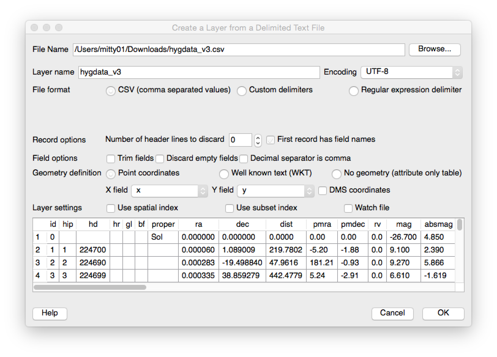
- Select Layer -> Add Layer -> Add Delimited Text Layer
- Browse to the file location, select File Format radio button as CSV and the rest should take care of itself
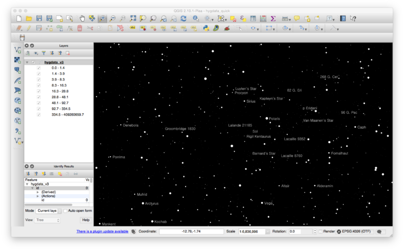
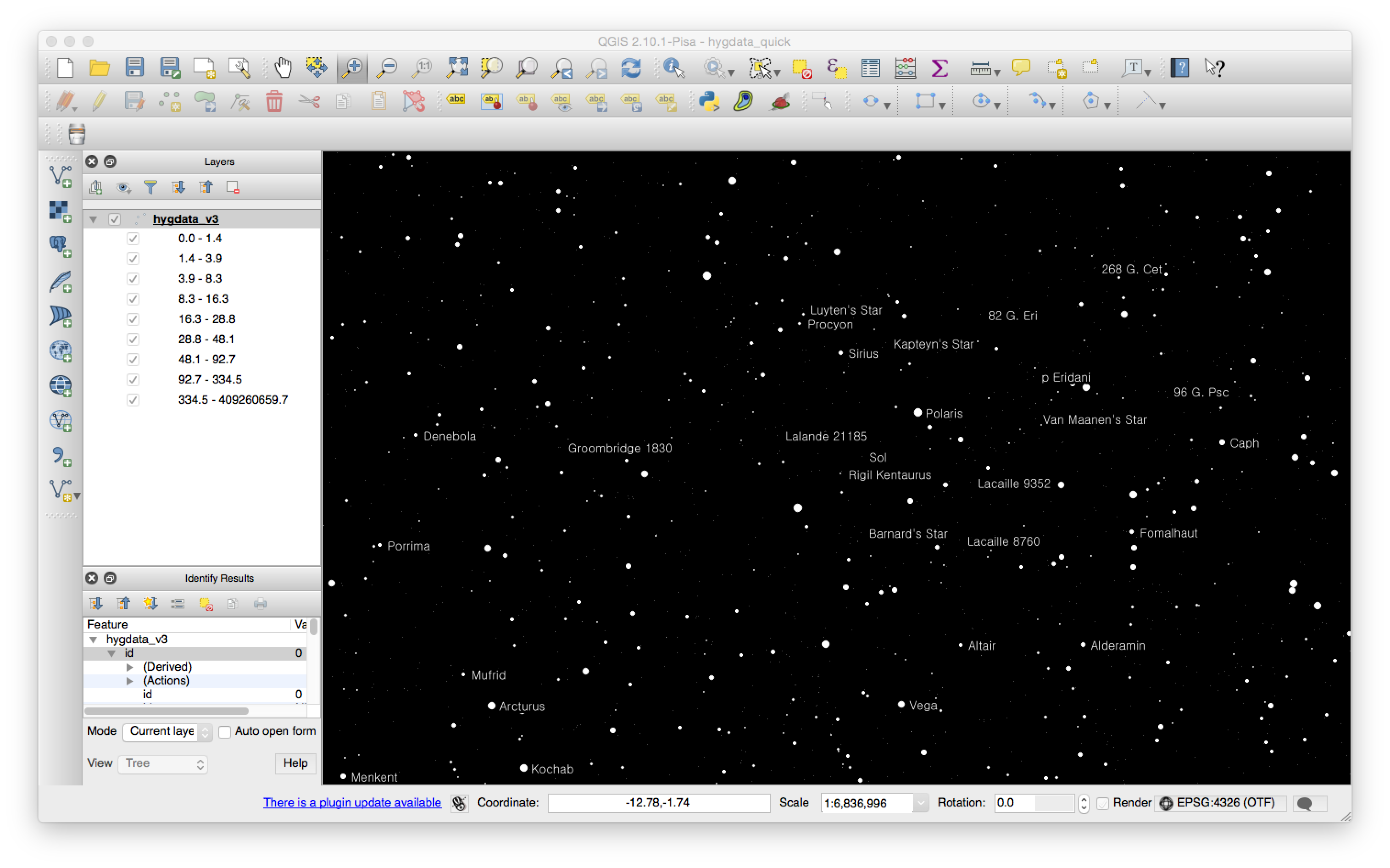
Tweak the Map
If you use a typical WGS84 projection you’ll get a ton of points oriented in a circle. I took a few minutes to zoom into a meaningful scale (for me it was around 1:5M), change the background colour and then use the LUM attribute to change the relative size of the stars. I also changed the colours to be shades of white. Here is what I was able to produce. It’s not all that meaningful to me but I know that when I need to dig into the data further it will be available!
I’ve attached my project file here so you can get started quickly.
I’d love to hear what you would use this kind of data for and if you have any tips for making it more useful or better rendered.